Spanish Pyrenees Itinerary: My 5 Day Road Trip
My road trip through the Spanish Pyrenees is one of the best trips I’ve ever taken, and I don’t say that lightly. Ever since I visited the Dolomites a few years ago I’ve been loving taking more trips in nature.
The Spanish Pyrenees has incredible hikes, charming medieval towns, and because they aren’t as popular as the neighbouring French Pyrenees, there’s not as many people around.
My boyfriend and I spent 5 days exploring the Spanish Pyrenees, with three main priorities for our road trip:
- It started and finished in Barcelona (as that’s where we live)
- It didn’t involve loads of driving each day
- We did some epic hikes with amazing views
The total drive time for this route is just under eleven hours across five days, with the biggest drives on the first and last day when you’re driving to and from Barcelona. Which means that most of your drives in between are short (and VERY beautiful).

Day 1: Barcelona – Alquézar
On the first day of our Spanish Pyrenees road trip, we drove from Barcelona to Alquézar, a medieval town in the foothills of the Pyrenees. The drive takes around three hours so I’d recommend starting as early as possible to make the most of the day.
I booked our hire car using Discover Cars, which compares the cost of loads of different providers to give you the best price.
If you’re arriving into Barcelona airport, you can pick your car up from there, but I always prefer to pick it up in the city as the queues in the airport can be huge, especially during the summer months.
We picked up a hire car from RecordGo next to Sants station in the centre of Barcelona at 7am, and arrived in Alquézar at 10:30am.
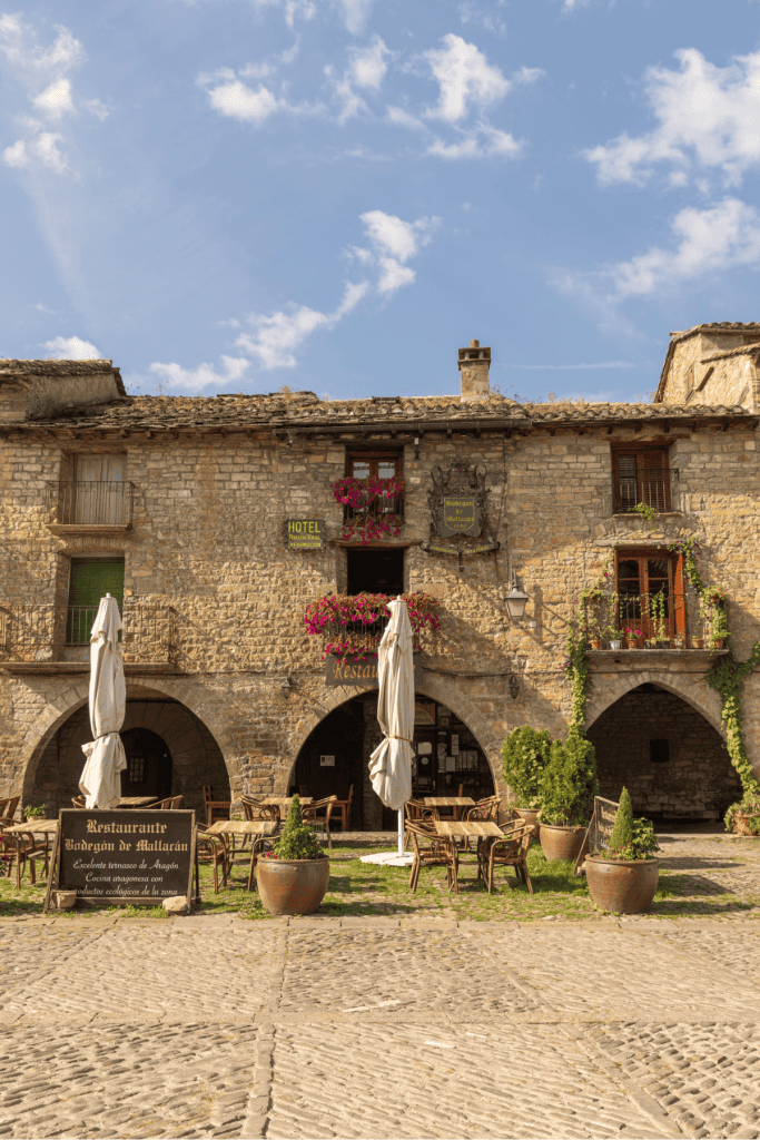
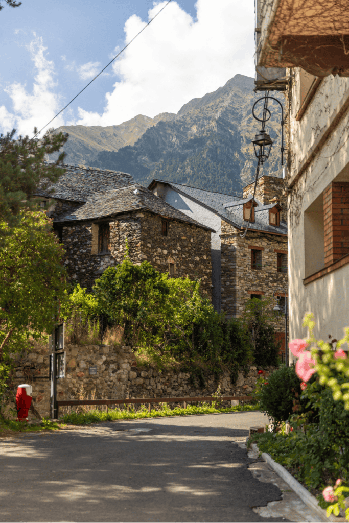
Alquézar is a small town with only several hundred people living there, but it’s absolutely beautiful.
As you drive towards it you’re greeted with the most incredible view of the houses seemingly emerging from the rock.

Parking: There’s plenty of parking in Alquézar. It costs €4.00 for the whole day.
The origins of the town can be traced back to the 9th century when a fortress was built under Moorish rule. Then, in the 11th century, the town was conquered by King Sancho Ramírez of Aragon and the fortress was converted into a monastery and a Christian church.
The rest of the town expanded around these central parts, and it’s an interesting mix of different architectural styles. It’s made up of cobblestone streets, old houses and some of the original defensive structures still remain.


Its been part of the Los Pueblos más Bonitos de España since 2015, an association that recognises the prettiest villages in the country.


Pasarelas del Vero
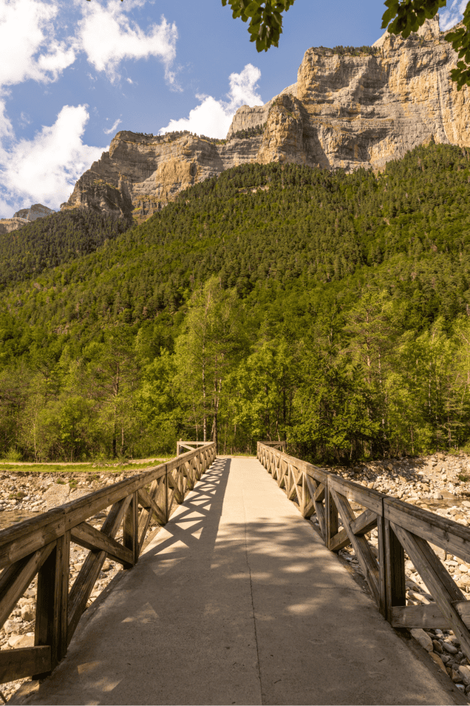
After exploring Alquézar for a couple of hours, we did the Pasarelas del Vero hike, which means “walkways of the Vero”, referring to the River Vero canyon.
Walk type: Loop
Distance: 3km
Getting there: Drive to the start of the route
Cost: €4.00 for parking and €5.00 per person for hike tickets
Facilities: Shops and restaurants in Alquézar, nothing on the hike

It’s a really easy 3km walk through the canyon, along a series of metal walkways that allow you to see the canyon below. I have a bad fear of heights and found these to be mostly ok, but if you’re absolutely petrified of heights you probably wouldn’t like this walk.


You’ll need to buy tickets for this walk, which are €5 per person. We bought ours online in the car on the way to the hike and there was still good availability, but this was at the start of September, so you might need to book further in advance if you’re visiting in summer.
Where to stay
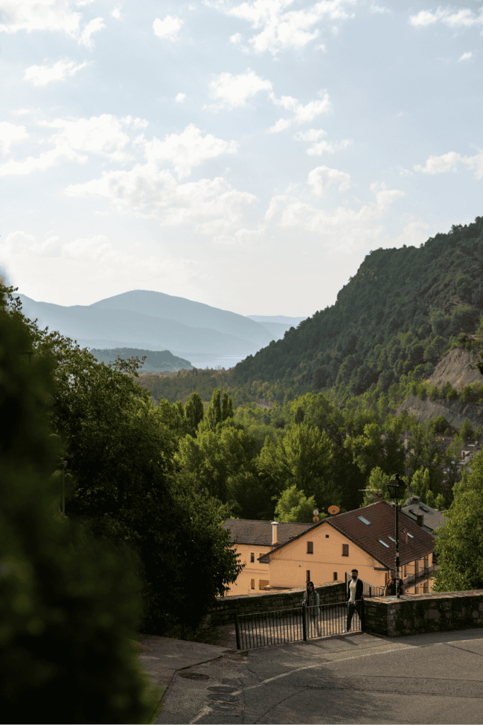
After finishing our walk we drove to Biescas, which was 1.5 hours from Alquézar. We chose Biescas as on day two we would be hiking in the Tena Valley, and it’s a great starting point for that area.
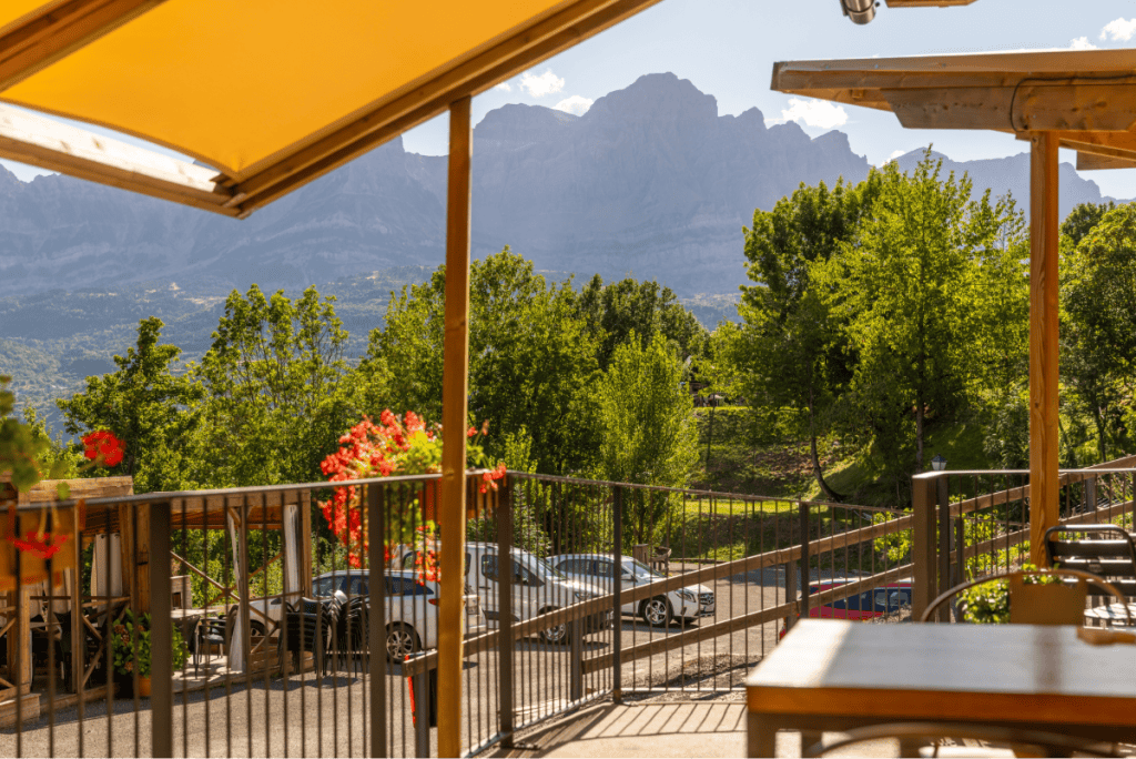
We checked into Tierra de Biescas for two nights, which was a really great hotel.
It was walking distance from the town, the rooms were spacious and modern, and best of all it had an indoor and outdoor swimming pool and a sauna, which was amazing after a long day of walking.

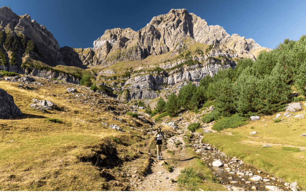
Day 2: Tena Valley – Ibón de Piedrafita
On day two in the Spanish Pyrenees we hiked to Ibón de Piedrafita.
From Biescas, it’s a twenty minute drive to Parking de Los Estachos, where the hike starts. Parking costs €3.50 for the whole day and you can pay with cash or card.

Walk type: Out and back
Distance: 8km
Getting there: Drive to the start of the route
Cost: €3.50 for the car park
Facilities: Drinks sold at the car park, nothing on the hike
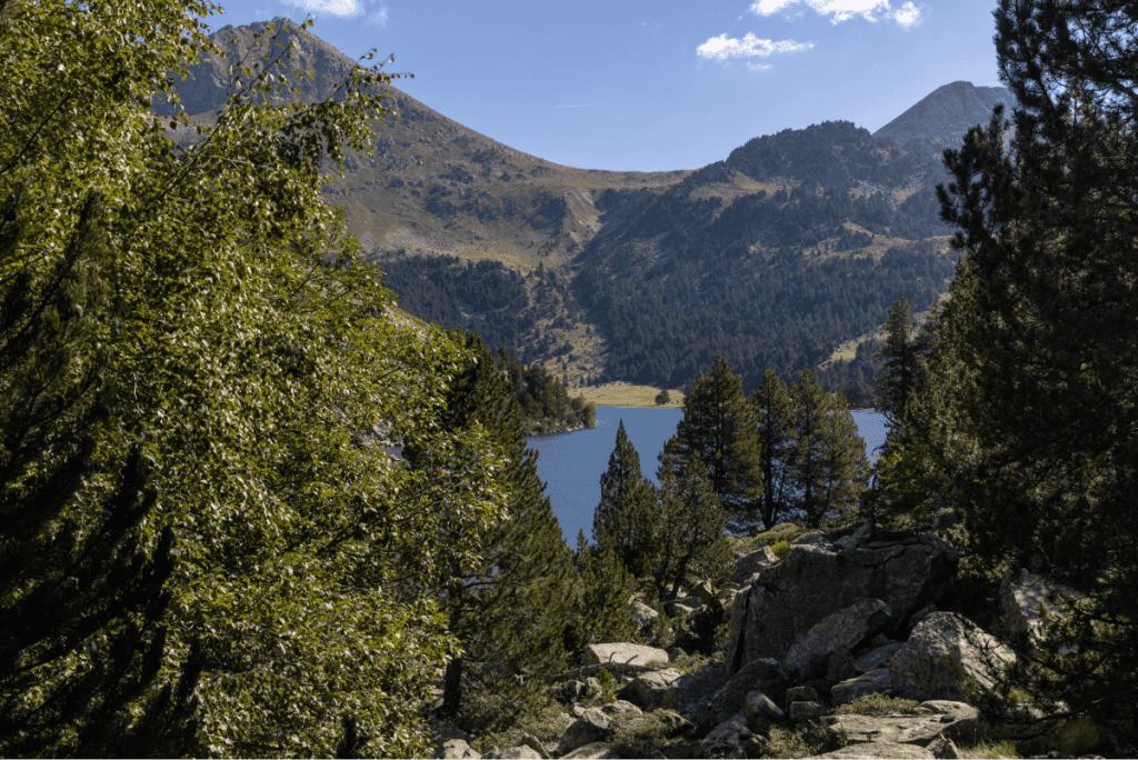
Ibón means lake in Aragonese, and the Ibón de Piedrafita is a glacial lake that sits at the bottom of Peña Telera, part of the Sierra de la Partacua mountain range.
It’s an 8km out and back walk, and it’s a really easy one so it’s good option if you’re travelling with children.

It starts on a gravel path surrounded by trees, and you’ll then go through enclosed forests for a short period before it opens up onto vast meadows.
You’ll hear the meadows before you see them as there’s so many cows, all with bells around their necks that ring as they move.

The view that greeted us as we walked out of the forest was breath taking – I couldn’t quite believe we were still in Spain.
With the sounds of the cows, lush meadows, and the dramatic mountains in the distance, it felt like a real life storybook.
The rest of the walk is through the meadows, with some elevation gain towards the lake. You can see mountains for the duration of the walk which is a great motivator if you’re feeling a bit tired.

Back in the car park, they sell beer from the same place you pay for your parking ticket, and there’s loads of chairs laid out so you can sit and enjoy the view. This was the best way to end our hike so I’d definitely recommend doing the same.
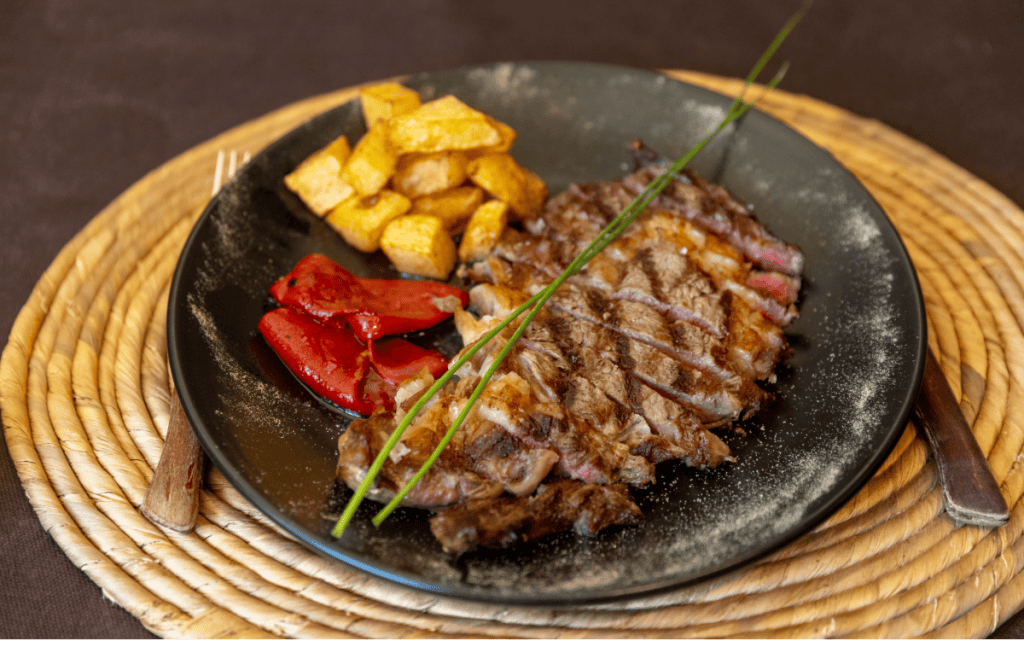
Lunch at La Era de Berdon
After the walk, we drove fifteen minutes to La Era de Berdón for lunch. We choose it because of its amazing reviews and the food was delicious, probably our favourite meal of the trip.
It’s hearty food which is great for refuelling after a big walk, I had a steak and my boyfriend had duck.
Acequia Trail
After lunch, Conor found a nearby walk on Wikiloc for us to do. It was a really easy walk with some nice viewpoints, but you spend quite a lot of time in woodlands without any views or scenery.
I prefer open walks where I can constantly be looking around at nature but it was still a nice way to spend a couple of hours.
We passed a brilliant bar so obviously we had to stop for a drink.
It’s rare to see restaurants along the trail in the Pyrenees and it reminded me a lot of the Dolomites so I was loving the chance to have a wine with a good view.
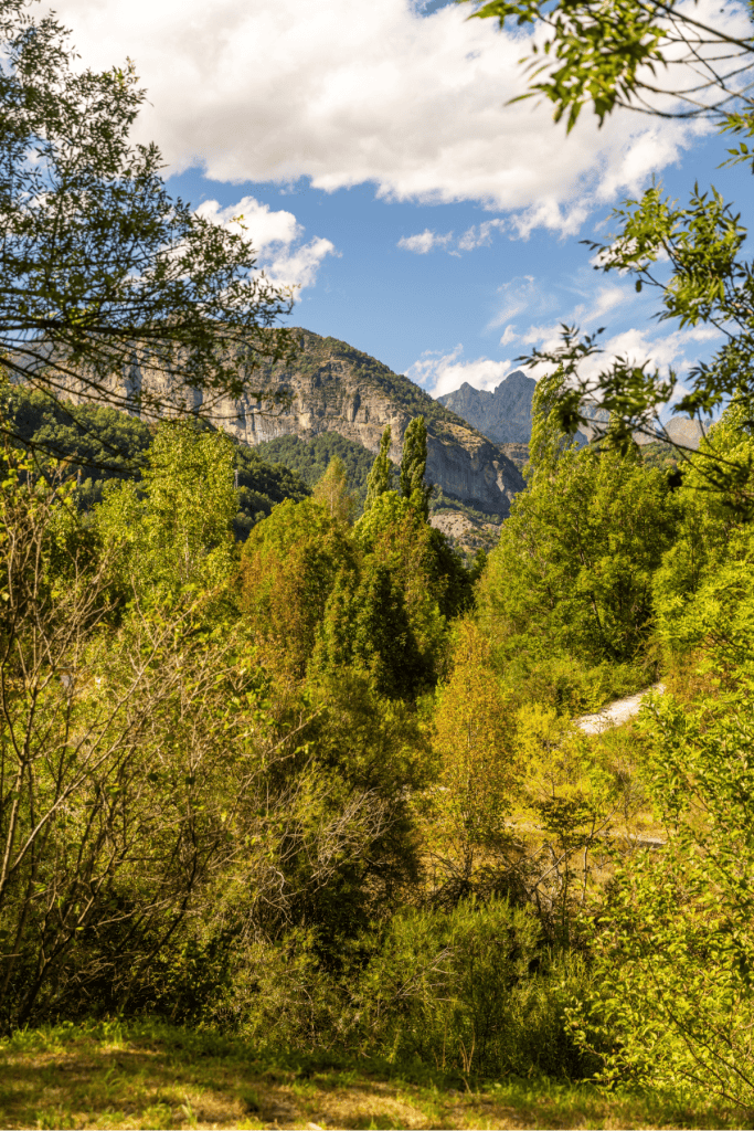
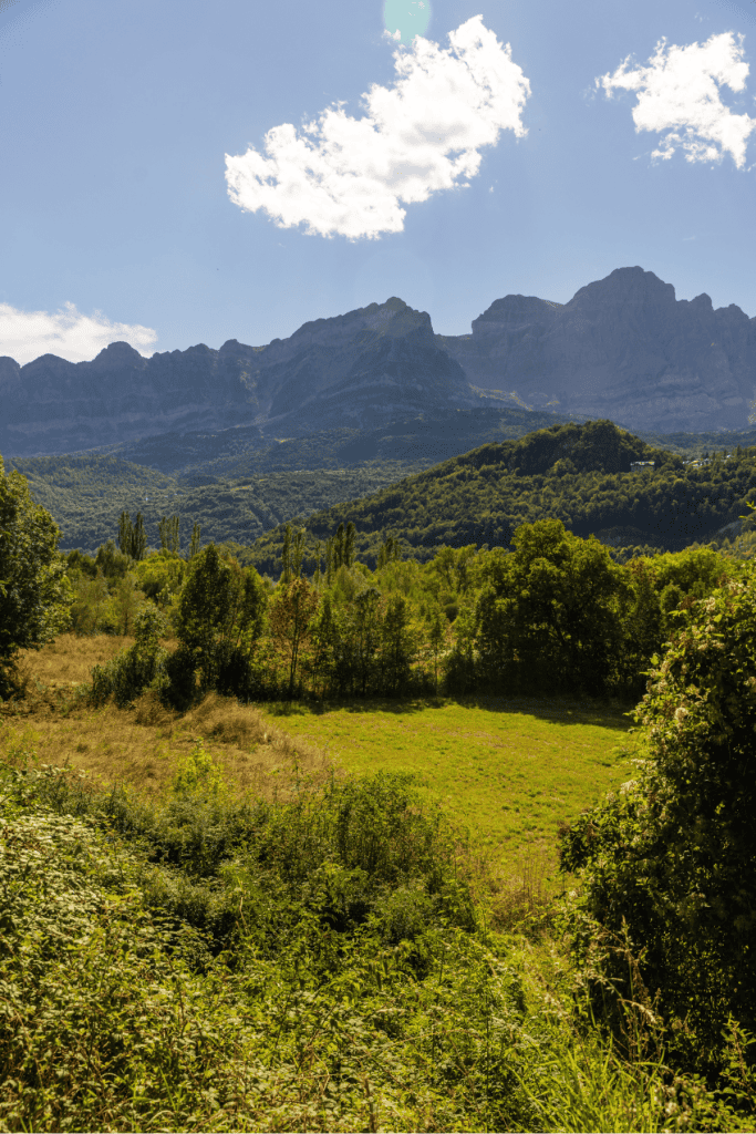
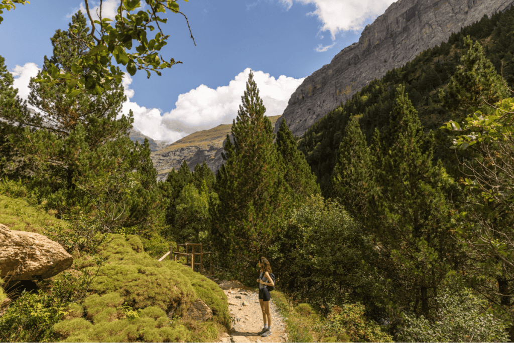
Day 3: Ordesa y Monte Perdido National Park
On our third day in the Pyrenees we drove from Biescas to Ordesa y Monte Perdido National Park, one of Spain’s oldest national parks. It’s a thirty five minute drive from Biescas to the starting point of the hike.
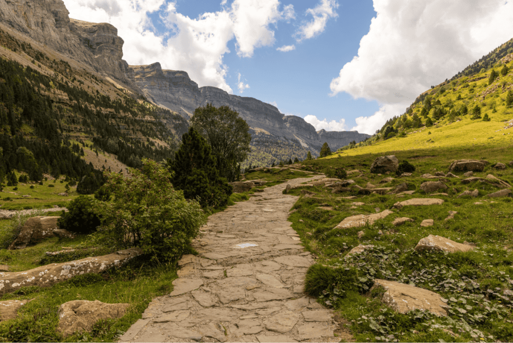
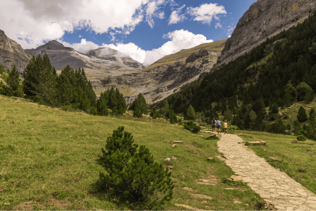
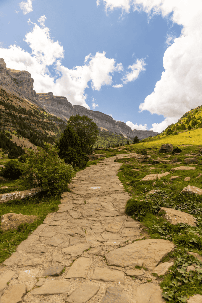
The most popular walk in the national park is the Pradera de Ordesa to Cola de Caballo, a 20km out and back trail to the Cola de Caballo waterfall. We knew we wanted to have one day of the trip where we did a huge walk, and this was the day.
Walk type: Out and back
Distance: 20km
Getting there: Drive and then bus
Cost: €6.00 per person for the bus
Facilities: Restaurant at the start of the hike, nothing during
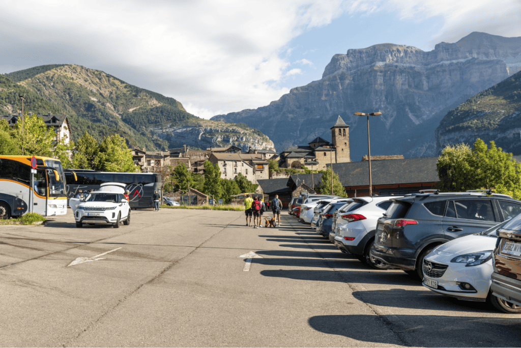
Parking: You can’t drive into the national park so you’ll need to park at the Ordesa y Monte Perdido National Park Visitor Centre. From there you can get a bus that will take you into the park. Bus tickets costs €6.00 per person.
Once you arrive at the start of the hike, there’s a shop and a restaurant. There’s no more amenities after this point. This is a BIG walk, so make sure you’ve got enough food and water.
We followed this Wikiloc although you don’t really need it as the route is very clearly marked.
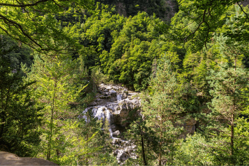
The main difference with the Wikiloc trail is that it had a few deviations for viewpoints overlooking waterfalls which were absolutely stunning and I’d definitely recommend doing.
The other major difference was that it would tell us to take shortcuts straight up through the forest rather than following the path round. This did save you time but often the path wasn’t very clear so we mostly stuck to the official route.
The first half of the walk is mostly through woodland without much of a view, and there’s a bit of elevation gain here which I really struggled with, I think probably because I was tired from the previous two days!
Once you reach the end of the climb, it opens up into the Gradas de Soaso – a huge meadow surrounded by the cliffs of the Monte Perdido.
This is where we stopped to have lunch and it was so special. It feels as though you’re a tiny dot in a huge bowl the way the mountains surround you and it gives you an amazing appreciation for nature.
The walk then continues to the Cola de Caballo waterfall. This was my favourite part of the hike as it was flat and the views are spectacular, have your camera ready because you’ll want to take lots of photos here.
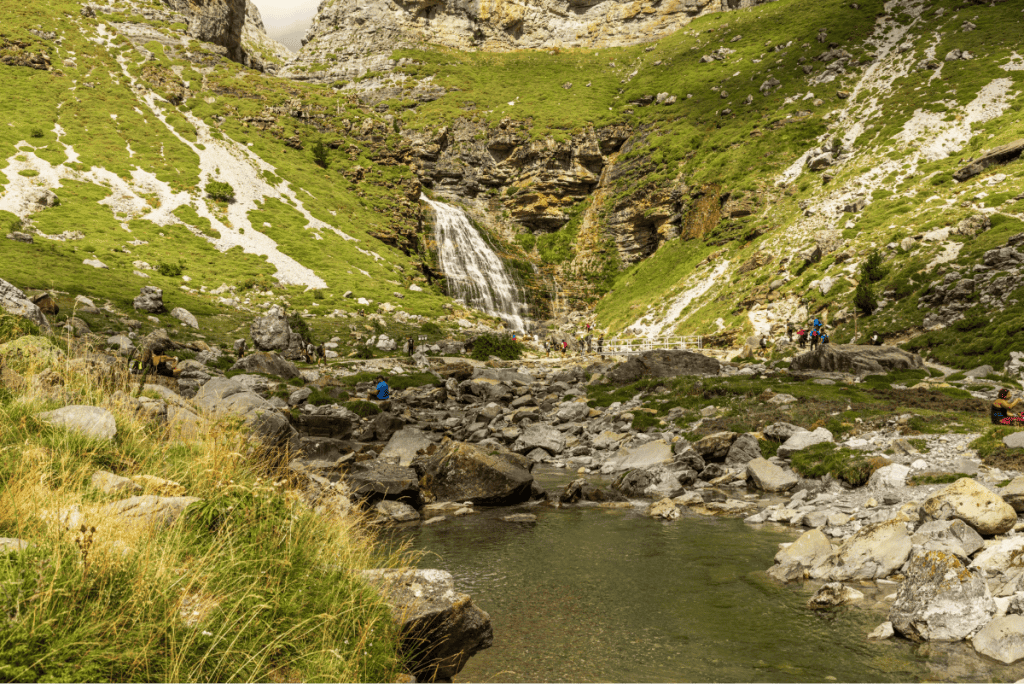
Once you reach the waterfall, you’ll turn around and follow the same route back.
It’s a lot easier on the way back as it’s mostly downhill or flat, and it’s a really interesting perspective to see everything from the other way.
Where to stay
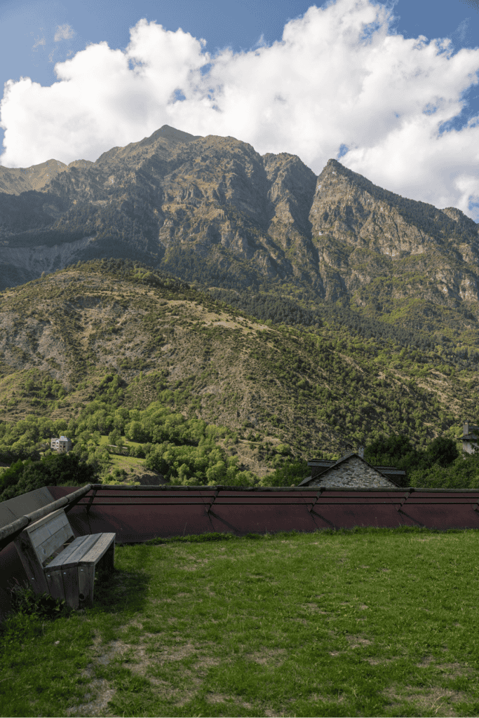
After finishing the hike, we drove 30 minutes to Aínsa. This town is absolutely stunning and by far my favourite place we stayed on the trip.
It’s also a member of Los Pueblos más Bonitos de España.

We stayed at Dos Rios, a modern hotel with a great bar, outdoor terrace and a rooftop pool.
It’s located outside the old town so the area isn’t as charming, but it means the accommodation is cheaper, and it’s only a ten minute walk to get to the old town.
Day 4: Aínsa and the Vall de Boí
After a long day of walking on day three, we decided not to hike on the fourth day and instead visit a few of the villages in the Spanish Pyrenees.
I always love pottering around villages so this was a very welcome break for me.
Aínsa
We started the morning in Aínsa, where we’d stayed the night before. We stayed in the newer part of Aínsa, but the best place to explore is in its medieval old town.

There’s a busy central square, the Plaza Mayor, which has lots of cafes and restaurants, and narrow cobblestone streets lined with shops. It’s really charming and because it sits on a hilltop, you get really beautiful views of mountains and the countryside.
Boí
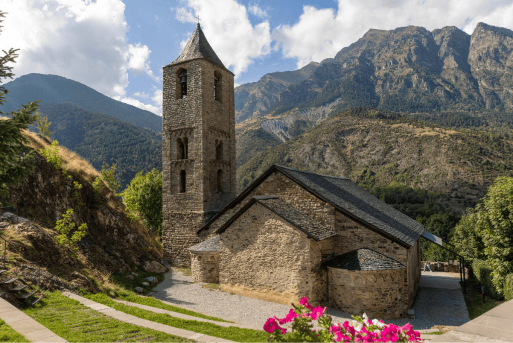
Next, we drove to Boí, which took around one and a half hours. Boí is a tiny village located in the Vall de Boí, a valley made up of eight villages.
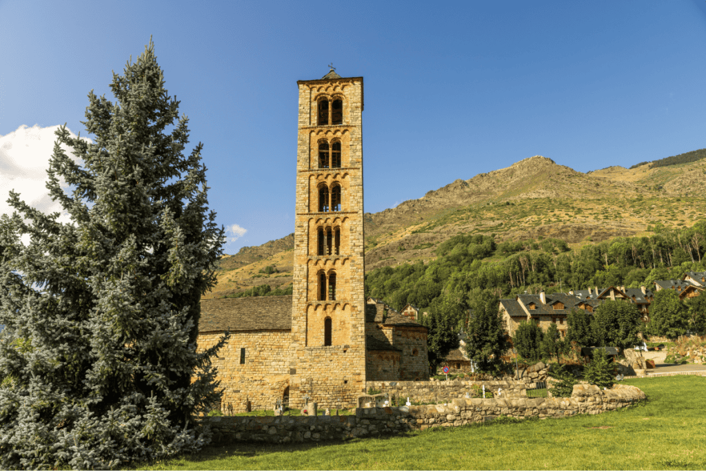
There’s not many amenities compared to Aínsa, but it’s really beautiful. The main thing to see here is the Sant Joan de Boí, a Romanesque church built in the 11th century.
With the bright flowers blooming in front of it, and a jaw-dropping mountain view behind, it’s a gorgeous spot for a picture.
Taüll
From Boí we drove five minutes to Taüll, another village in the Vall de Boí.
Taüll is slightly bigger than Boí, with more hotels and restaurants. It’s also home to two more Romanesque churches – Sant Climent de Taüll and Santa Maria de Taüll.
Erill la Vall
Erill la Vall was the final village we visited. It’s a ten minute drive from Taüll, also in the Vall de Boí.
It was the smallest of the three villages, but it’s really charming, with a Romanesque church in the centre.
We had a drink at Hostal La Plaça which has incredible views from the garden overlooking the mountain, before heading to dinner at La Granja.
The food here was fantastic and really well priced, with a menu of the day for €23.00.
Where to stay
We loved the laidback charm of Erill la Vall a lot so we decided to spend the night there at a hotel called L’Aüt.
Rooms were basic but clean, with stunning views of the mountains.

Day 5: Aigüestortes i Estany de Sant Maurici National Park
On our last day, we headed to Aigüestortes i Estany de Sant Maurici National Park, the only national park in Catalonia.
The most famous walk here is the hike to Estany de Sant Maurici, a glacial lake that sits at the bottom of Els Encantats, a mountain made of up two dramatic peaks.
I really wanted to do this walk but the starting point is in Espot, in the eastern part of the park.
From Erill la Vall, it’s a two hour drive to Espot, and we were then driving back to Barcelona the next day which would be another four hours.
So instead, we chose to stay in the western part of the park and hike to Estany Llong, as the starting point was only a six minute drive from Erill la Vall.
Estany Llong
Estany Llong is a glacial lake surrounded by pine forest and dramatic peaks. It ended up being my favourite walk of our trip to the Pyrenees so I’m really glad we did this one instead (even if it wasn’t on purpose).
To reach the start of the hike, you’ve got a couple of options.
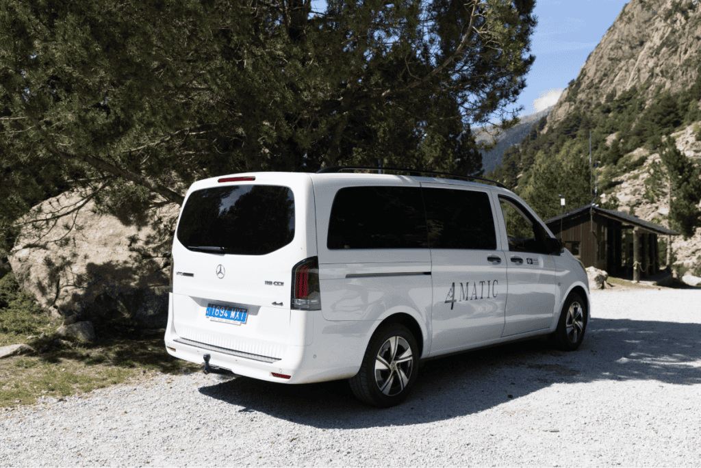
You can’t drive into the national park itself so you can either park in the Aparcament de la Palanca de la Molina car park and then walk up, or you can take a 4×4 taxi from the car park into the national park. This is what we did as we didn’t fancy adding extra time to the walk.
A return journey is €11.50 per person – not cheap, but worth it.
The taxi’s come every twenty minutes and seat seven people, so you might need to wait for a space as they pick people up in Boi first.
If you prefer, you can also park in Boi so you’re first on.
Walk type: Out and back
Distance: 10km
Getting there: Drive and then 4×4 taxi
Cost: €11.50 per person for the taxi
Facilities: Refugio serving food and drink near the lake
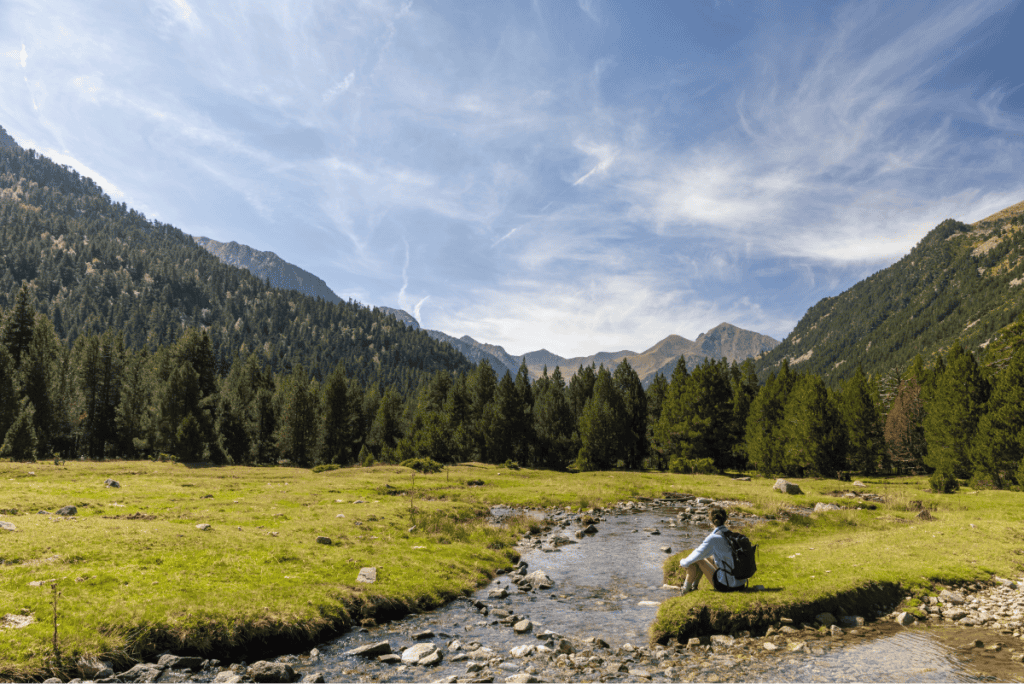
This walk is a 10km out and back route to Estany Llong through Aigustortes national park.
It’s an easy route with only around 100 metres of elevation gain, which I appreciated after our huge walk on day three.


The route is mostly open (not through dense forests), so you get amazing views the whole time, and it follows the Sant Nicolau River so you have running water as your background noise.
Phone signal: There’s no signal within Aigustortes national park, so make sure you download your route ahead of time so you can use it offline.
Once you reach the lake, the path opens up into a meadow full of cows, and for the first time on the trip we saw horses!
I’d been on the look out for them all week so I was delighted to see them on our last day.

The walk follows the same route back to the car park, but as always it was really nice to see a unique perspective. You’ll pass the Refugi d’Estany Llong on your way back, which is a great place to stop for a beer and some hearty food.
Back to Barcelona
Once we were back at the car park, that marked the end of our five days in the Spanish Pyrenees and we made our way back to Barcelona.
Planning your trip to the Spanish Pyrenees
Getting around
We rented a car for our trip to the Pyrenees and we’d have been pretty lost without it. It gave us total flexibility to go wherever we wanted, and to stop off and take pictures at viewpoints.
We picked our hire car up from RecordGo next to Sants train station in Barcelona and it cost us €120 for five days, which included the cost of an additional driver.
We could have paid a lot less if we picked it up from Barcelona airport, but I know first hand from living here for three years what a nightmare experience that is.
The queues can take two hours during summer, whereas it only took ten minutes for us to be in our car and on the way to the Pyrenees.
I always use Discover Cars when I’m hiring a car as they compare the cost of loads of different providers to give you the best price.
Preparing for a hike
Unlike places like the Dolomites, where you’re often hiking hut to hut and you can rely on buying snacks and drinks from Refugio’s, the hikes in the Spanish Pyrenees don’t have much in terms of facilities.
Come prepared and bring everything with you, and pack plenty of water and food to last you for your hike.
Leave no trace
It goes without saying that whatever you bring with you on a walk, you need to take home with you.
There’s no bins on these hikes, so it’s your responsibility to carry your rubbish with you. I’d recommend having a plastic bag with you so you can keep it in there and dispose of it when you get back.
Restaurants
I don’t know whether it was just the time of year we were visiting, but we found a lot of restaurants were closed. On our second night in Biescas, 90% of the restaurants were closed.
Our hotel told us that they close on Tuesdays, but it meant we had very little choice of where to eat.
Even in other towns, there wasn’t a lot open, so I’d definitely recommend researching places in advance so you know what to expect, or booking Airbnb’s so you can make your own food.
This is what I’ll do next time so we can make lunches for our hikes too.


